Excursion Description
The hiking along the Northeast Rift is a great must-do of Etna North that allows you to retrace the fragility of a hyperactive territory in the last 100 years of the volcano's history in just 10km.
The excursion starts at Piano Provenzana, the main tourist hub of Etna North at an altitude of 1800 m.a.s.l., where along trail 702 we will first see the remains of a hotel almost completely buried by the 2002 activity.
We will continue towards the lateral cone of Monte Nero (1646-47 eruption), one of 5 cones with the same name on Etna, whose geographical position gave it the name "Northern Monte Nero" (Jean-Claude Tanguy, 1980). Behind it is the Timparossa beech forest and the gateway to the deeper Etna north, with its rope lavas from the 1614-24 eruption.
At its southeastern base is the 1911 hornitos battery, almost aligned with the 1923 eruptive fracture, two of the most recent and dangerous activities that, in the last century, threatened the town of Linguaglossa.
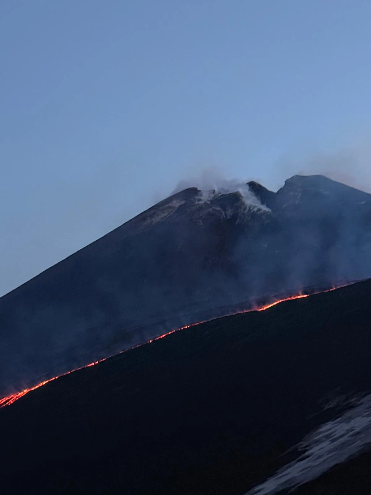
Our hiking continues towards the terminal cones of the 2002 fracture, the eruption that destroyed the ski resort in a few days and compromised tourism in the entire Etna North tourist area for years. We will walk on the rim of the lateral craters that, in that October 2002, through strombolian and effusive activity distinctly marked the landscape with signs still visible today.
The higher we climb, the more it will be possible to perceive the impact of such violent and sudden eruptive activity, both towards the Ragabo woods (mainly composed of Laricio Pines) and towards Piano Provenzana.
Reaching an altitude of about 2100-2200 meters a.s.l. you have an overview of the entire route taken, clearly reading the landscape crossed: from Monte Nero and the 1911 buttonhole, the 2002 effusive flow, the ski resort and the clear signs of 2002 activity. On the clearest days it's possible to admire the view of the Aeolian Islands in the distance, 150 km from Piano Provenzana.
We continue until reaching the approximate altitude of 2300 m a.s.l. at the base of the lateral cone of Monte Pizzillo (around 980 AD), one of the most important crater rims of Etna north, and then approach the 1947 hornitos battery.
The descent along the Rift takes place along a plateau-like area that borders the 1879 lava flow until reconnecting with Monte Nero and a wonderful Timparossa beech forest that borders it from above. The circuit closure includes a final passage through the 1923 and 2002 lava fields, before returning to Piano Provenzana.
This is a particularly educational excursion, suitable for families or school groups that tells, in an exhaustive and complete way, the fragility of the relationship between the unique landscape of Piano Provenzana and the volcano that hosts it.
What the excursion includes
- Authorized volcanological guide;
- Trekking poles.
Book your Etna adventure
Experience a unique educational journey retracing 100 years of volcanic history. Contact us to book your Northeast Rift excursion.
- The program may vary during the day due to variable weather and volcanic conditions.
- Good physical conditions are required for the described activities.
- The excursion is not recommended for those suffering from asthma or heart problems.
- The minimum number to confirm the excursion is 3 adults (€300). If this number is not reached, the equivalent fee must be considered to confirm the excursion in private form.
- Basic volcanological conditions provide for no presence of volcanic gases, but are subject to change based on weather.
- Type of terrain: fine volcanic sand, unstable and abrasive volcanic rocks, moderate slopes.